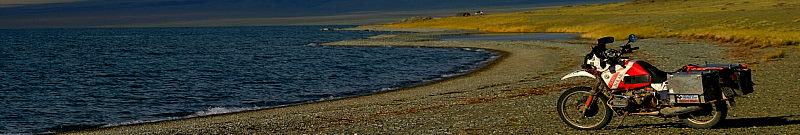

(Along the cordillera heading north)
Leaving Ushuaia was a lot harder than we thought. The weather was co-operting, so there seemed to be no reason to leave. As I have already mentioned, everyone we knew that had been down here, and everyone whom we told we were heading here told us the same, mainly that there is a lot of wind coming down, and lots of wind going up. In addition most complained about the "unstable" weather. For our part, we had nothing but calm weather, no wind, sunshine during the day, and cool evenings. In a word, perfect. But of course eventually we had to get back on the road. The plan was to head north along the cordillera. We had reliable information that the Route 40 was the most scenic road in all of Argentina so we were looking forward to checking it out. Also, on the route was the Perito Moreno glacier which was something I had wanted to have a look at for many years. So on a beautiful day we had our last look at the Southernmost City in the World (tm), and headed north.

(View of Lago Roca & Perito Moreno glacier)
We headed to Porvenir, Chile, where we wanted to cross over to Punta Arenas and from there north back into Argentina. The road is dirt and to our surprise had little traffic, and even better some great vistas. When we rode along Bahia Inutil we saw dolphins which was really nice. At Porvenir we found that the ferry didn't show up until late at night, so we skipped it and continued by road around the peninsula, heading for the ferry crossing that we had used coming down. The following day we crossed, straights of Magellan, and shortly thereafter the border back in to Argentina at the same place where we had come in, and continued north.

(On the road to El Calafate, it is cold and rainy!!)
From Rio Gallegos (the first town in mainland Argentina after the border), we headed towards El Calafate. Calafate is the town from which you go and visit Perito Moreno, and other glaciers on the Lago Argentino. We got wet and really cold getting there, but once there the temperatures got better. We skipped the town and headed to a campground at Lago Roca which we had been told about by the tourist bureau. This was the campground nearest to glacier, although it was still 50km away. Unfortunately the other campground at the glacier were no longer open, so this was our only choice. It turned out to be the best campground we had been in yet, and in fact one of the only ones which we would actually consider going to just to vacation, it was that good. Right on the lake, with a beautiful vista, quiet, relaxing, and still it has all the amenities which one needs (eg. hot water showers, a shop, restaurant, etc.). As a bonus, we got a rabbits and foxes trotting by everyday.

(The Perito Moreno glacier)
We spent a few days here, having a look at the Glacier and doing a little hiking. The glacier was really fantastic. We spent the whole day there, just staring wide eyed at the natural spectacle in front of us. At the glacier there is a visitor center where they have various galleries from which you can watch and listen to the glacier. Even from the parking lot you get a good panoramic view of the glacier and the lake. At the time we where there the glacier came all the way across to the to the peninsula cutting off a part of the lake. This is something which apparently happens pretty regularly, and eventually the lake water will break through and restore the flow of water to the part of the lake which had been cut off. The Perito Moreno glacier is one of the few glaciers in the world which is growing. It is moving into the lake and as it does, it calves (chunks break off) creating small icebergs. This is the spectacle which everyone comes here to see, and no-one is disappointed. Not only that but the noise from moving glacier is fascinating. It is easy to spend hours and hours watching and listening to the glacier, truly a once in a lifetime experience.

(Lago Roca)
A really enjoyable outing from the campground, was climbing the mountain across the road, Cerro Crystalo. It took us the better part of an afternoon, but it was well worth it. The views from there go as far as Torre del Pine peaks in Chile to the Perito Moreno glacier and the flat lands in the direction of El Calafate.

(On the road to El Chalten, Fitzroy is in the background)
The next stop was El Chalten a bit further north. This is the main walking, climbing, hiking, and mountaineering area of Argentina. It is also the location of one of Fitzroy, one of the most difficult mountains to climb. There are a number of other mountains in the area, and of course plenty of nice walking and hiking paths. The town itself is under construction, but has all the requirements for the massive amounts of tourists who come here to enjoy the natural beauty. We spent a few days and walked some of the trails before continuing north.

(Road along the Cordillera)
Once we left El Chalten, the roads changed drastically (for the worse). There is not much of anything but wide open country, and too our dismay the first day we had a lot of wind. As I mentioned previously we had pretty much avoided all bad weather down here up to now, but as we left Tres Cruses just north of El Chalten, we got hit by a 60kph side wind and to make it worse, this is where some pretty bad dirt roads started. In addition to the bad roads, there was also plenty of construction going on in various stretches, making it even more trying. We battled through and made it to Bajo Caracoles which is basically a rest stop in the middle of nowhere. The town had a total population 32, but they had 2 places to camp and gasoline. From here we deviated from 40 and headed towards Lago Posada and then north along route 41. The stretch between Lago Posada and Los Antiguos, which lies on Lago Buenos Aires right on the border to Chile, is one of the most scenic roads we have taken so far. It goes up and along the mountains which make up the border to Chile. There is a little of everything here, green fields, desert, high plains, salt flats and more. The road is challenging but did not pose any major problems. Our motto is basically, "easy does it". A lot of these roads are extremely dangerous and damaging to both man and machinery if one goes too fast. Traveling slowly not only lessens the wear and tear, but also allows more time to enjoy the traveling, and of course much less dangerous to boot.

(Along the Cordillera on the way to Los Antiguos)
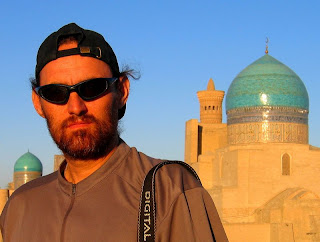
Los Antiguos is a pleasant town, the center of Cherry production in Argentina of all things. This being Argentina, they have turned this fact into a tourist destination by offering tours of the various orchards. Most larger orchards offer not only tours but all sorts of additional attractions, like handy crafts, accommodations etc. This wasn't really the season, so everything was pretty low key. Unfortunately for me, a toothache which had been bugging me for a few days finally got bad enough that I went to the Hospital. As luck would have it, I had to get a wisdom tooth pulled, but as it happen to be a long holiday weekend, I had to wait 4 days. The dentist gave me some drugs and told me to come back at 7 on tuesday to get an appointment.
I spent the weekend looking for the oil pressure problem which I had first noticed in Rio Gallegos. Unfortunately at the end of the weekend I was not any closer to fixing the problem, and my toothache was only getting worse. The problem with the bike was basically that with low revolutions and a warm engine, my oil pressure light was coming on. Low oil pressure is one sure way to kill an engine. I did some research, asked everyone that I could think of, and implemented a number of solutions. They all failed spectacularly to solve the problem. So Tuesday morning I got my appointment, and at 10:00, I got my wisdom tooth pulled. Despite the lack of a solution to my technical problem, the following day we continued on into Chile and the Carretera Austral (Southern road).

(Looking back south and the Carretera Austral, Chile)
The Carretera Austral is a very popular route as it runs along the Cordillera on the Chilean side. The main difference to the Argentinian side is that it is green and fertile, while the Argentinian is usually dry and desert like. What was surprising was how green and scenic it was, kind of reminded me of Switzerland. We came back into Argentina a few hundred kilometers north and continued on along the Argentinian side. The main reason being that everything in Chile is more expensive, from Gasoline to food.


(On the road to Bariloche, and sunrise over lake Nahuel Huapi)
Once back in Argentina, we continued to head north on the route 40. There is not much here, plenty of sheep and cattle country, and a few towns dedicated to tourism. Esquel for example is a major ski destination. A bit further north is Bariloche, a playground for the rich, poor, partying teens, and sports lovers from everywhere. It is spectacularly situated on the lake Nahuel Huapi and is in the middle of national park of the same name. There are a number of lakes and forests all around so it is truly picturesque. I found it extremely touristy and for some reason very "fake". There is a road along the lake which is always full of traffic, there are lodges, hotels, restaurants, and stores. One good thing, there is a good camping along the lake, where the morning sunrises are absolutely unforgettable. So I guess you have to take the good with the bad. One interesting fact about Bariloche, is that teens from all over southern South America (Chile, Argentina, Uruguay, Southern Brazil, Paraguay) come here for their Class trips and birthdays. Something like Yucatan or Florida for college and pre-college students in the U.S. where they go on their "Spring Breaks". As such it has the infra-structure to support this (Bars, clubs, discos, etc.). In addition it is also a Winter playground, as it gets plenty of snow.

(Traffic problems in the mountains..)
Between Zapala and San Rafael we even discovered fossils during a short lunch break. In addition the road takes you through plains dotted with volcanoes which along the mountains. Incredible sights, with some really incredible distances, few people, lots and lots of sheep and Guanacos.

(Lunch on the road)
Further on, south of San Rafael we start getting into the wine area of Argentina. The vistas don't really change much, flat sandy country, backed by the high spines of the Andes. But nearer San Rafael, besides the winyards, there is also lots of fruit cultivation. On nearer analysis, you start noticing the canals everywhere, which make all this possible. By the time you get to Mendoza you hardly pay attention anymore, to the fact that this is all desert, but it is still green. All in all an incredible ride from the southernmost city in the world(tm) to the center of Argentine wine production.
Technorati Tags: Argentina, bmw, calafate, chalten, motorcycle, perito moreno, travel
No comments:
Post a Comment